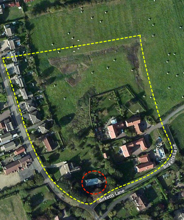
Where are located in Lincolnshire, England. Our postcode for anyone wishing to visit is LN11 0PF. The church itself sits within an enclosure (no public access) the traced outline of which is shown below in yellow and St Bartholomew’s in red. As stated elsewhere the enclosure was bulldozed destroying the surface archaeology and the northern end of the 15 metre wide moat was backfilled. As with the church, this site would have changed over the years in terms of structures and functionality.
Back in 2019 Dr Duncan Wright was contacted and reported “That enclosure you mention is of interest—it looks substantial and is most likely the remains of a late medieval (13th-14th century) moated site. The ridges emanating to the north looks like ridge and furrow, again probably of later medieval date.“
Whilst work on the south transept was being completed
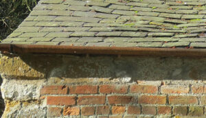
it came to light that the wall plates had been recycled, they are good quality sandstone kneelers, possibly from one of the buildings within the enclosure. Further down this page you will also find a map of the wider area should be on holiday in the area.